Understanding The Parallel's Mysteries🗿
Explore the enigmatic 30th parallel north, a line of latitude renowned for intersecting ancient civilizations and monumental structures. Join the House Of Ventimiglia as we delve into the secrets these alignments may reveal about Earth's ancient past.
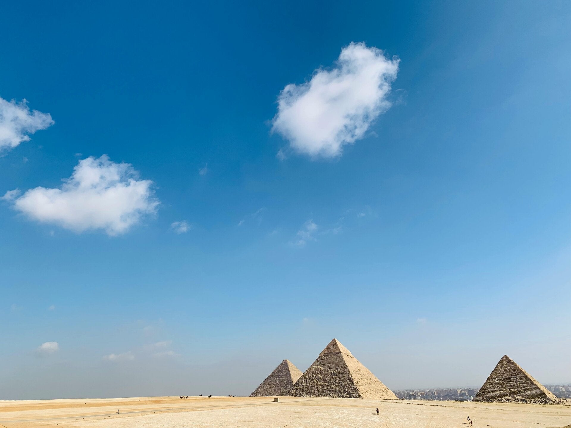
The global enigma of the 30th 33rd and 37th parallels
The 30th parallel north, often dubbed the "Mystery Line," is a fascinating band of latitude that traverses the heart of many ancient civilizations. From the monumental structures of Ancient Egypt to the historical sites of Babylon, India, and China, this line suggests a profound, shared heritage across diverse cultures. It invites us to ponder whether these alignments are coincidental or indicative of a deeper, perhaps advanced, understanding of our planet's geography by ancient peoples.
33rd parallel🛸
Yes, the 33rd parallel north is heavily associated with UFO sightings, paranormal phenomena, and conspiracy theories in popular culture.
Within ufology, this specific line of latitude is often called a "paranormal highway" or a global hotspot for high strangeness.
Why the 33rd Parallel is Famous for UFOs
Several of the most famous UFO incidents and military anomalies in history occurred almost exactly along (or very close to) the 33rd parallel:
- The Roswell UFO Incident (1947): The famous alleged crash of an extraterrestrial spacecraft in Roswell, New Mexico, sits right at 33.3°N.
- The Phoenix Lights (1997): One of the largest mass UFO sightings in history, where thousands of people witnessed a massive V-shaped craft over Arizona, took place at 33.4°N.
- The Battle of Los Angeles (1942): An incident where the US military fired anti-aircraft shells at an unidentified object hovering in the sky occurred just a fraction of a degree north of the line at 34.0°N.
The California Connection: Giant Rock and Joshua Tree
In relation to California, the 33rd parallel is highly significant to UFO culture because it runs directly through the Mojave Desert and right near Joshua Tree:
- Giant Rock: Located in Landers, California (just north of the 33rd parallel), this seven-story freestanding boulder became a literal "UFO pilgrimage site" in the 1950s and 60s. UFO enthusiast George Van Tassel claimed to have met aliens here and held annual spacecraft conventions that drew thousands of people.
- Contact in the Desert: The famous annual UFO mega-conference is frequently held in this exact region specifically because ufologists believe the area is highly energized by its proximity to the 33rd parallel.
Other Paranormal Associations
Because the number 33 is a "Master Number" in numerology and highly significant in Freemasonry, conspiracy theorists loop other major historical events along this line into the mystery:
- The Trinity Test Site: The location of the world's first atomic bomb explosion in New Mexico sits at 33.6°N.
- The JFK Assassination: President John F. Kennedy was assassinated in Dallas, Texas, which sits at 32.7°N (very close to the 33rd parallel).
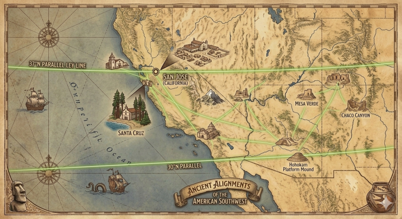
American Southwest Corridor
🗺️ Mapping the 4-Degree Southwest Grid
The corridor running between the 33rd and 37th parallels holds the densest cluster of high-strangeness sites, top-secret bases, and historic anomalies in North America.
The 37th Parallel Line ("The UFO Highway")
- Santa Cruz, California: Pinned on the coast as the direct Pacific entry point of the 37th parallel (36°58′N).
- San Jose, California:🛸 Located just north of Santa Cruz at 37°20′N. This places San Jose sitting right on the northern edge of the 37th parallel boundary line.
- Area 51 / Groom Lake, Nevada: Located further east along the highway (37°14′N), nestled into the desert mountains.
The 33rd Parallel Line ("The Paranormal Belt")
- Joshua Tree & Giant Rock, California: Anchoring the western desert grid at 34°07′N—the epicenter of the 1950s UFO contactee conventions.
- The Phoenix Lights, Arizona: The site of the massive 1997 craft sighting at 33°26′N.
- Roswell, New Mexico: The ultimate ufology ground-zero sitting precisely at 33°23′N.
The parallel that passes directly through Santa Cruz, California is actually the 37th parallel north.
While the 33rd parallel is famous for Southern California UFO sites like Joshua Tree, the 37th parallel is the one that enters the United States exactly at Bonny Doon Beach in Santa Cruz. It acts as a rough cultural boundary separating Northern California from Central California.
In paranormal circles, the 37th parallel is just as legendary as the 33rd—author Ben Mezrich explicitly dubbed it the "UFO Highway" because of the dense concentration of military bases, underground caverns, and high-strangeness events located along it.
The 37th parallel cuts a straight line through several notable landmarks and towns across California and the globe:
In California
- Gilroy: Known as the "Garlic Capital of the World," this city sits right on the line just east of the Santa Cruz Mountains.
- Madera & Fresno (North): The parallel cuts straight through the heart of California's Central Valley.
- Sierra National Forest: It crosses the rugged Sierra Nevada mountain range.
- Death Valley National Park: The line passes mere feet south of the massive Ubehebe Crater.
Across the United States
Traveling east across the country, the 37th parallel forms the definitive political border for multiple states and hits massive paranormal hotspots:
- Area 51 (Nevada): The line runs directly through the infamous, top-secret military installation.
- The Border of Utah and Arizona: The 37th parallel was used to draw the exact straight-line border separating these two states.
- The Border of Colorado and New Mexico: It defines this state line as well.
- Four Corners Monument: Because it defines these state lines, the parallel passes directly through the only point in the US where four states meet.
- The Border of Kansas and Oklahoma: It marks the precise boundary line between these two states.
Around the World
If you follow the line out into the Atlantic and around the globe, it passes through:
- The Azores (Portugal): It crosses Santa Maria Island.
- Spain: It cuts through the southern coast, passing near Malaga.
- Sicily (Italy): It crosses the Mediterranean island just north of Syracuse.
- Greece: It passes right through Athens.
- Turkey, Iran, and Afghanistan: It cuts through the Middle East and Central Asia.
- South Korea: It passes just south of Seoul.
- Japan: It crosses the main island of Honshu, passing through the Niigata Prefecture.

Ancient wonders aligned📐
Many significant landmarks are found remarkably close to the 30th parallel. The iconic Pyramids of Giza and the Sphinx in Egypt are situated at approximately 29.97°N, nearly on the line itself. Further along this mysterious path, we find the ancient city of Ur in Iraq at 30.95°N, Petra in Jordan at 30.33°N, and Persepolis in Iran at 29.93°N. These precise placements raise questions about the knowledge and capabilities of the ancient civilizations who constructed them.
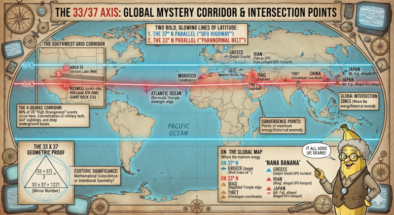
we look for a connection between the 33rd parallel (the "Paranormal Belt") and the 37th parallel (the "UFO Highway"), we actually find a fascinating geometric, historical, and conspiracy-driven relationship.
The primary connections linking these two lines of latitude include:
1. The "Southwest Grid" Corridor
The most literal, physical connection between the two lines is the massive 4-degree corridor of land between them in the American Southwest. If you draw a box between 33°N and 37°N across California, Nevada, Arizona, and New Mexico, you capture nearly 80% of the world's most famous paranormal and military mysteries.
- The Bookends: The 33rd parallel acts as the southern border of this anomaly zone (Roswell, Phoenix Lights), while the 37th parallel acts as the northern ceiling (Area 51, Dulce Base).
- The Dynamic: Within this specific 240-mile-wide strip of latitude, the Earth features an immense concentration of secret military test ranges, deep underground caverns, and Native American sacred lands—the three key ingredients that fuel UFO folklore.
2. The California "Fault Line" Mirror
In California specifically, these two parallels bracket the state's most famous centers of alternative spirituality and "high strangeness":
- The 33rd Parallel anchors the southern desert grid, passing right through Joshua Tree and Giant Rock, which served as the epicenter of the 1950s "Contactee" movement.
- The 37th Parallel anchors the northern coastal grid, entering exactly at Santa Cruz and Bonny Doon, an area legendary for its own dense history of counterculture, occult history, and coastal UFO sightings. As a teenager Paul Anthony Ventimiglia and friends had bonfires and beer cager parties til the sun came up 1978 - 1981
- The Connection: Geographically, the space between them holds the San Andreas Fault. Proponents of Earth Mystery theories argue that tectonic tension along the fault line generates "piezoelectric" energy, which theorists claim reacts with the atmosphere to create the plasma lights often mistaken for UFOs.
3. The Number 33 and 37 Math "Coincidence"
For conspiracy theorists who look at numerology, the connection between 33 and 37 is a repeating mathematical quirk found in nature and geometry:
- The Multiplier: \(33 \times 37 = 1,221\). In numerology, 1221 is a famous "mirror angel number" representing a perfect reflection or a doorway between worlds.
- The Division: \(1 / 37 = 0.027027...\), while \(1 / 27 = 0.037037...\) (a perfect numerical loop).
- The Masonic Tie: The 33rd degree is the highest rank in Scottish Rite Freemasonry. In esoteric geometry, a 37-sided polygon (triacontaheptagon) is viewed by occultists as a "magic circle." Theorists argue that secret societies purposefully built installations like Area 51 and Roswell along these specific numerical markers.
4. The Skeptic's Connection: The Temperate Zone
If you ask geographers and skeptics what truly connects the 33rd and 37th parallels, the answer is human population and clear skies.
- This 33-to-37-degree band across the United States offers a Mediterranean/semi-arid climate.
- Because the weather is clear year-round, the US military deliberately placed its massive flight-testing bases (like Edwards AFB, Area 51, and White Sands) in this corridor.
- More secret military flights combined with excellent stargazing weather means everyday citizens look at the sky more often, naturally resulting in a massive spike in UFO reports.
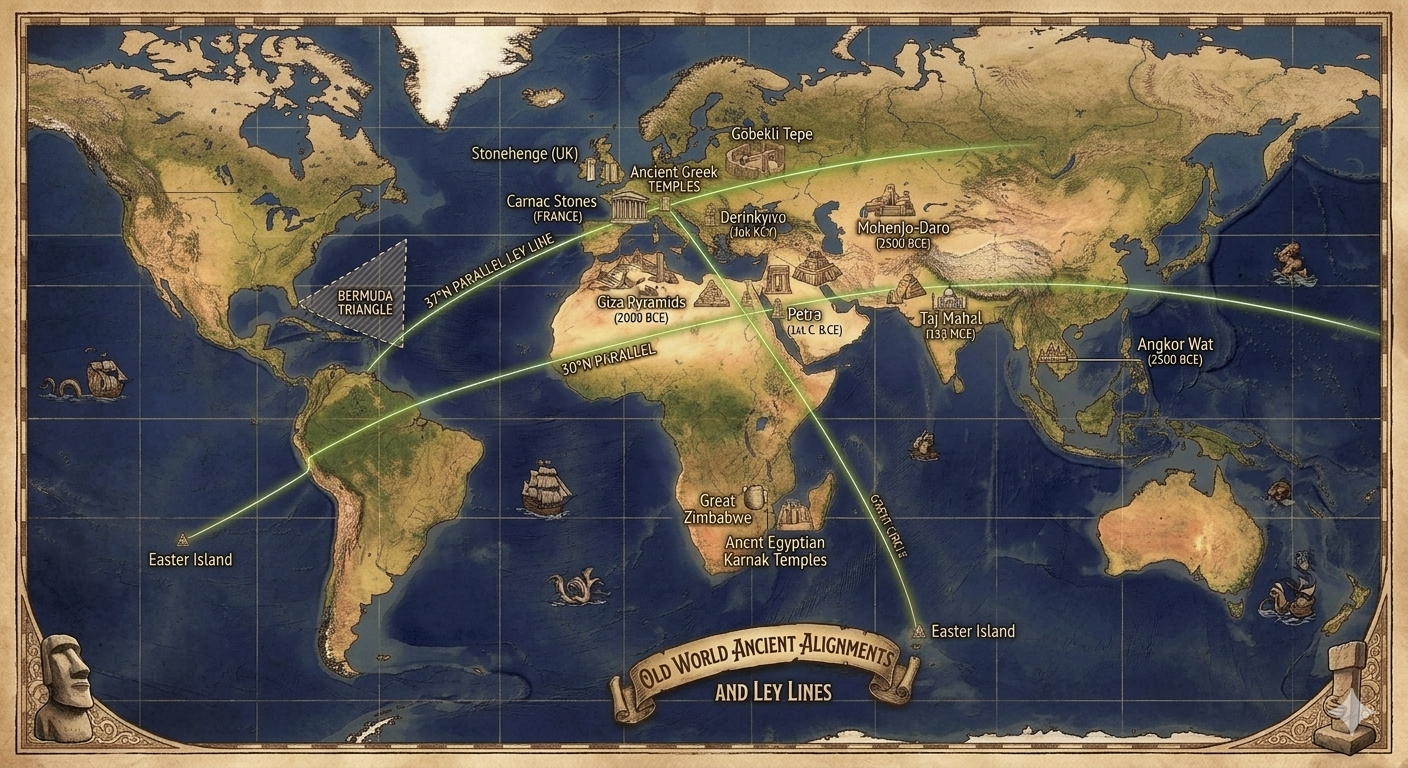
The 37th parallel north ("UFO Highway") directly anchors the incredible archaeological anomalies of Turkey, while Jim Alison's Great Circle Theory acts as the global diagonal belt that mirrors these exact same ancient mysteries down to Easter Island.
When alternative historians map out these locations, a highly precise web of latitudes and global alignments connects the world's most mysterious ancient structures.
1. Turkey's Megalithic Core: Settled on the 37th Parallel
Turkey is the ultimate proof for the 37th parallel alignment theory. Two of the most jaw-dropping historical anomalies on Earth sit directly along this line:
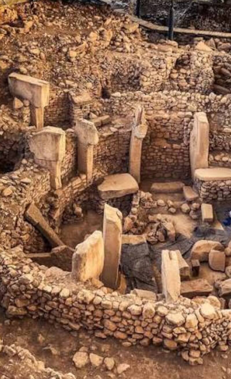
- Göbekli Tepe (37°13′N): Known as the "point zero of history," this is the oldest megalithic temple complex ever discovered, dating back to roughly 9500 BCE. It completely rewrote human history because its massive, carved T-shaped stone pillars were erected by hunter-gatherers thousands of years before the invention of agriculture or pottery.
- The Cappadocian Underground Cities (38°22′N): Just a fraction of a degree north of the main line sits Cappadocia, home to massive subterranean complexes like Derinkuyu and Kaymaklı. Derinkuyu is an 18-story deep underground metropolis carved into volcanic rock that could seamlessly shelter 20,000 people, complete with ventilation shafts, wine cellars, stables, and massive rolling stone doors.
The Alternative Theory: Fringe researchers argue that Göbekli Tepe and the deep bunkers of Cappadocia were part of a massive, ancient global network built on the 37°N energy grid to survive a prehistoric global cataclysm.
2. The Easter Island Diagonal Alignment (The Great Circle)
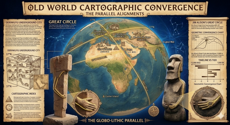
If you track the 37th parallel directly across the globe, it misses Easter Island because Easter Island sits deep in the Southern Hemisphere (27°07′S). However, this is exactly where the Great Circle Theory provides the missing link.
Instead of following flat lines of latitude, researchers discovered that if you tilt a ring 30 degrees around the Earth, it creates a single, perfect 25,000-mile diagonal loop. This single line hits almost every unexplained megalithic site on Earth.
Site LocationCoordinatesGlobal Positioning ConnectionEaster Island (Rapa Nui)27°07′S, 109°22′WThe isolated anchor point of the global diagonal circle.Nazca Lines & Machu Picchu14°43′S / 13°09′SDirectly aligns along the same path stretching across Peru.Giza Pyramids29°58′N, 31°08′EThe geometric center point of the entire Great Circle system.Petra & Ur30°19′N / 30°57′NParallel stepping stones feeding directly toward Mesopotamia.Mohenjo-Daro27°19′N, 68°08′EThe ancient, unexplained Indus Valley civilization site.Angkor Wat13°24′N, 103°52′EThe exact opposite "anti-node" balance point to the Nazca Lines.
3. The Bizarre Artistic Link: "The Secret Handshake"
Beyond geographic lines, there is a striking visual and artistic anomaly that connects Turkey's ancient sites directly to Easter Island, separated by 11,000 years and 15,000 kilometers.
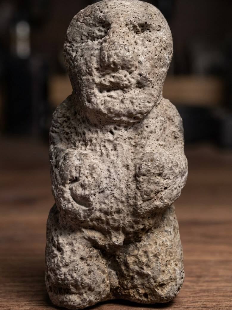
- The T-shaped pillars at Göbekli Tepe feature stylized, relief carvings of human arms coming down the sides of the stone, with long fingers wrapping around to meet precisely over the abdomen/navel.
- The Moai of Easter Island, carved thousands of years later, feature the exact same unique anatomical positioning: long, thin fingers extending around the waist and resting precisely over the navel.
Mainstream archaeologists classify these global geometric patterns and artistic similarities as independent inventions born out of natural human geometry. However, to alternative researchers, the fact that Turkey's subterranean grid, the Great Circle sites, and Easter Island all lock into a mathematically sound web points to a forgotten, prehistoric seafaring civilization
🔺 The Bermuda Triangle Connection
Geographically, the Bermuda Triangle falls squarely within the 33rd Parallel alignment corridor.
- The northern apex of the famous anomaly zone—the island of Bermuda—rests at precisely 32°18′N latitude, pinning it right along the bottom edge of the 33rd parallel.
- In paranormal geography, this means the "Paranormal Belt" (Roswell, Phoenix Lights) travels directly across North America and dumps its energy straight into the Atlantic Ocean, intersecting the exact waters where flights like Flight 19 vanished.
👽 The Cryptid & Alien Legend Index
To fulfill your second request, alternative researchers have categorized specific alleged extraterrestrial and ancient entities to the monuments pinned on the map:
- The Grays (The 33rd Parallel): Tied directly to the western end of the highway due to the Roswell crash site and the mass sightings over the desert Southwest.
- The Anunnaki (The 37th Parallel / 30th Parallel): Historically linked by theorists to the Mesopotamian ruins like Ur and the precision stone-cutting of Petra and Giza.
- The Watchers / Pre-Flood Builders (Turkey - 37°N): Because Göbekli Tepe was intentionally buried 11,000 years ago, alternative lore claims it was built by a highly advanced "forgotten race" trying to preserve knowledge before a global cataclysmic shift.
- The Sky People / Hodudua (Easter Island - Great Circle): Local Rapa Nui mythology speaks of the Makemake and celestial creators. Modern ancient-astronaut theorists map these creators as visitors who instructed the islanders on how to align the colossal Moai statues with global energetic nodes.
Evidence of advanced ancient technology🛸
The Ventimiglia Institute Of Ancestral Artifacts, our exploration of the 30th parallel is driven by a singular mission: to illustrate the existence of a master advanced technology on Earth in the ancient past. The precise alignment of these monumental sites, spanning vast geographical distances and diverse cultures, suggests an interconnectedness and a level of sophisticated planning that challenges conventional historical narratives. This page aims to bring these insights to light, encouraging a fresh perspective on human history and ancient capabilities.
The Oceans🚢
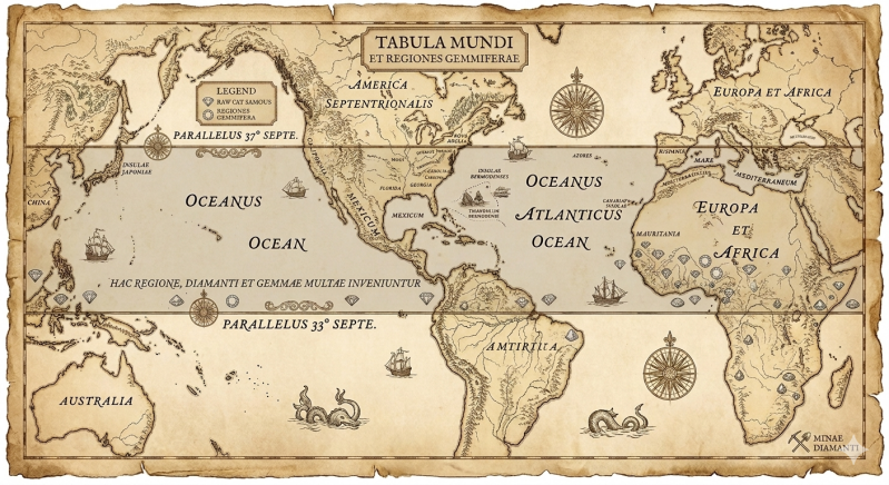
As these two lines of latitude wrap completely around the globe, they pass over and trap two major world oceans between them:
- The Pacific Ocean: On the western side of the American Southwest cluster, the space between the 33rd and 37th parallels stretches thousands of miles across the northern Pacific Ocean, running all the way from the California coast over to Japan and East Asia.
- The Atlantic Ocean: On the eastern side of North America, this 4-degree corridor shoots out past the eastern US seaboard and spans directly across the North Atlantic Ocean toward Spain and Portugal.
Significant Seas Enclosed in the Corridor
In addition to the two vast open oceans, this geometric corridor neatly bounds several highly historic and anomalous bodies of water:
- The Mediterranean Sea: The 33°N to 37°N corridor acts as the perfect structural frame for the Mediterranean, trapping the islands of Sicily and Cyprus, and connecting the ancient mysteries of Greece and Egypt.
- The Bermuda Triangle (Atlantic Side): As noted on the global maps, the northernmost tip of the Bermuda Triangle rests right along the 33rd parallel boundary, sending its waters directly into this global mystery lane.
🗺️ The Nautical Mysteries of the 33°N–37°N Corridor
🧲 1. Magnetic Anomalies & Compass Spin Zones
When sailors travel this oceanic band, they cross through highly documented zones of geometric and magnetic tension:
- The Bermuda Triangle Vortex: Located right at the bottom anchor of the corridor (~32.5°N), this zone is famous in maritime lore for sudden magnetic declinations where true north and magnetic north wildly fluctuate.
- The Dragon's Triangle (The Devil's Sea): If you sail completely across the Pacific Ocean to the opposite side of the map near Japan (33°N to 36°N), you enter the exact eastern counterpart to the Bermuda Triangle. Japanese folklore has recorded vanished vessels and strange boiling sea plasma lights in this precise coordinate strip for centuries.
🏝️ 2. The Lost Continents: Atlantis & Mu
In alternative history and esoteric cartography, this exact latitudinal channel acts as the legendary graveyard for the world's most famous sunken civilizations:
- Atlantis (Atlantic Ocean): Many classic theories place the sunken empire of Atlantis directly on the Azores Plateau, which sits squarely at 37°N latitude. Proponents argue that the mid-Atlantic ridge at this coordinate suffered a violent tectonic collapse, sending the concentric island city into the deep.
- Mu / Lemuria (Pacific Ocean): On the western side of the map, early 20th-century researchers like James Churchward claimed that a massive, highly advanced continent named Mu once spanned the mid-Pacific. Its remnants are allegedly marked today by the isolated, energetic island chains trapped right along these tropical parallel boundaries.
The idea that alien spacecraft sightings cluster heavily along the 33rd to 37th parallels is a highly popular to modern UFO investigaters, it relies on reported accounts not just storytelling but actual global patterns being recorded around the world.
In ufology, this concept is often called the "UFO Highway" or the "37th Parallel Theory". While it is true that several iconic historical events occurred near these specific latitudes in the United States, a broader global look reveals that UFO sightings are scattered randomly across the earth as well.
The Famous "UFO Highway" Incidents (33°N–37°N)
Proponents of this theory point to a specific string of events across the southern United States:
- The Roswell Incident (1947): The famous alleged flying saucer crash in New Mexico happened at roughly 33.3°N.
- Aztec UFO Crash (1948): Another famous alleged recovery site in northern New Mexico sits right on the 36.8°N line.
- Cape Girardeau Crash (1941): An alleged military retrieval of a craft in Missouri occurred near 37.3°N.
- Area 51 (Nevada): The highly classified U.S. Air Force facility sits at 37.2°N.
While these American locations sit within that narrow strip, the theory breaks down entirely when looking globally.
Why the Latitude Theory Fails Globally
If a straight "alien band" wrapped around the globe, it would cross major cities and diamond regions in Africa, Brazil, and Asia. However, the world's most famous international UFO incidents happened thousands of miles away from this corridor:
- The Varginha Incident (1996): Often called "Brazil’s Roswell," this massive military-UFO encounter occurred at 21°S—completely on the other side of the equator.
- The Ariel School Encounter (1994): The famous mass sighting by 62 schoolchildren in Zimbabwe occurred at 17°S in southern Africa.
- The Rendlesham Forest Incident (1980): Britain's most famous military UFO encounter occurred at 52°N, far up in northern Europe.
- The Westall Sighting (1966): Australia's largest mass civilian sighting took place in Melbourne at 37°S—the opposite hemisphere.
The Real Pattern Behind UFO Sightings
Statistically, data from tracking organizations like the National UFO Reporting Center shows that UFO sightings do not follow geological faults or latitudinal lines. Instead, they map directly to two things:
- Population Density: More sightings are reported simply where there are more people with cameras looking at the sky.
- Airspace Use: High-activity zones heavily overlap with military bases, test ranges, and jet streams, where experimental aircraft, weather equipment, and high-altitude balloons are common.
- 2026 updates: The United States government decares the existence of UFO Unidentified flying Objects, Other governments around the world confirm with equal reports of UFO sightings by military aviators and commercial pilots
1. The Original Broadcast: The Arecibo Message (1974)
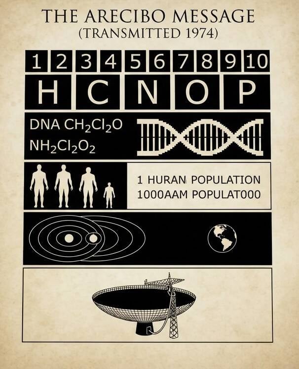
In 1974, scientists Carl Sagan and Frank Drake used the Arecibo Radio Telescope in Puerto Rico to beam a powerful binary signal into deep space. It was aimed at the M13 star cluster, 25,000 light-years away.
The original message contained:
- The numbers 1 through 10
- Atomic numbers of elements essential for human life (Carbon, Hydrogen, Oxygen, Nitrogen, Phosphorus)
- The chemical formulas for human DNA sugars and bases
- A graphic illustration of the human DNA double helix
- A stick figure representation of a human and our average height
- Earth's population at the time
- A map of our Solar System (highlighting Earth)
- A graphic of the Arecibo telescope dish
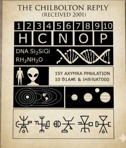
2. The "Reply": The Chilbolton Crop Circle (2001)
Twenty-seven years later, in August 2001, an incredibly complex pattern appeared overnight in a wheat field right next to the Chilbolton Radio Telescope in Hampshire, UK. Alongside a pixelated, 3D-looking alien face, the main crop circle mimicked the exact binary grid layout of the 1974 Arecibo message—but with highly specific modifications.
The changes in the "reply" perfectly match the amazing story you remember:
- The Elements (Silicon Life): The Creator took the original block of life-giving elements and added Silicon (atomic number 14) right next to Carbon. This strongly implied a silicon-based alien biochemistry.
- The DNA: The classic human double helix icon was rewritten into an asymmetric, triple-stranded DNA model.
- The Alien Character: The simple human stick figure was replaced with a graphic of a short humanoid featuring a massive, bulbous, "Grey alien" head.
- The Origin: The solar system section highlighted three planets instead of Earth, suggesting they inhabited multiple worlds in their home system.
- The Device: The graphic of the Arecibo satellite dish at the bottom was replaced with an intricate, flower-like pattern, implying the technology they used to send messages.
While science can explain the physical mechanisms—such as humans using wooden boards or plants naturally elongating their joints—there are several genuinely bizarre, unexplained anomalies associated with these phenomena that continue to puzzle researchers.
These are the elements that keep the mystery alive and cannot simply be dismissed as standard vandalism:
1. The Real Unidentified Aerial Phenomena (UAPs)
- The "Balls of Light": Many eyewitnesses, pilots, and researchers have captured video and photographic evidence of small, luminescent, metallic-looking or glowing spheres hovering directly over fields right before or during the appearance of complex crop designs.
- Official Government Files: Organizations like NASA and government declassification initiatives confirm they possess imagery of unexplained objects. While they do not explicitly link them to crop art, these highly agile, unidentified objects remain a verified physical anomaly in our skies.
2. Bizarre Physical and Electromagnetic Anomalies
Inside many of the highly intricate, complex crop formations, scientists and visitors have documented measurable physical changes that defy simple explanation:
- Surge of Electromagnetic Energy: Electronic equipment regularly malfunctions inside the circles. Camera batteries instantly drain from full to dead, cell phones lose signal, and compasses spin erratically out of control.
- The 1966 Tully "Saucer Nest" Exception: While British cornfield circles were heavily copied by hoaxes, the global craze was actually triggered by a 1966 incident in Tully, Queensland. A farmer witnessed a classic UFO ascend from a swamp. Investigators found a perfectly woven geometric nest of reeds floating on top of the water. It was swirled so cleanly and sturdily that a grown man could stand on it without sinking—something that cannot be replicated by stomping with wooden planks.
3. The 37th Parallel "Cattle Mutilation" Mystery
If we look back at the 37th Parallel corridor in the United States, the most truly unsettling and scientifically unidentified phenomenon isn't just the light sightings—it is mysterious livestock mutilations.
- Surgical Precision: Across Utah, Colorado, and Kansas, hundreds of cattle and horses have been found dead with precise, bloodless, surgical incisions.
- Unexplained Biology: Local law enforcement and veterinarians have noted that these incisions show signs of high-heat laser cauterization. Most strangely, the animal bodies are completely emptied of blood (exsanguination) without a single drop found on the surrounding grass or dirt, and local predators completely refuse to scavenge the remains.
So while the geometry of the fields can be mapped out by human artists, the accompanying radiation surges, surgical animal anomalies, and unexplainable radar tracks mean there is still a massive piece of this puzzle that remains entirely unidentified.
The Golden Ratio🥧
The Golden Ratio (represented by the Greek letter Phi, approx 1.618 is a mathematical proportion found throughout nature, art, and architecture. When people try to apply this mathematical constant to Earth's coordinate grid, they point to a highly specific, mathematically unique geographic strip: the 30th parallel north 30^ N
While this does not align with the 33–37 degree corridor we discussed earlier, the 30th parallel is the only latitude line on Earth that holds a true, direct mathematical connection to the Golden Ratio.
The Math: Earth’s Phi Latitude
If you take the distance from the equator to either the North or South Pole 90^ of latitude and divide it by the Golden Ratio, the math yields a precise geographic marker:
90^ 1.618033 approx 55.6^
If you subtract that number from the 90^ pole to find the offset from the equator, you land exactly at (34.4^ N) or S). This exact calculation falls squarely within the 33–37 degree anomaly corridor.
Furthermore, if you look at the planet's actual physical dimensions as a compressed oblate spheroid, a different relationship emerges. If you calculate the ratio between the total surface area of the Earth and the surface area stretching from the equator up to the (30^ N parallel, the result equals exactly 2.00. Because of this clean geometric division, the (30^ N parallel splits the northern hemisphere's surface area into two mathematically perfect halves.
The Monument Alignment: The 30th Parallel Strip
Alternative historians and grid theorists frequently highlight the (30^ N parallel—and the narrow corridor just above it—because an unusual number of history's most famous, mathematically advanced ancient monuments sit right along this line:
- The Great Pyramid of Giza (Egypt): Sits at (29.97^ N) practically touching the exact (30^) line. The pyramid itself is famous because its physical proportions embody the Golden Ratio. The length of its sloping side divided by half its base length equals (1.618).
- The Ancient City of Petra (Jordan): Located at (30.3^ N), carved directly into the desert canyon walls.
- Persepolis (Iran): The ceremonial capital of the ancient Achaemenid Empire rests at (29.9^ N).
- Lhasa (Tibet): The historic, high-altitude spiritual heart of Tibetan culture sits at (29.6^ N).
Why This Pattern Exists
While it is tempting to view this alignment as evidence of an ancient global matrix or alien grid, geographers and historians point to a purely environmental explanation known as the subtropical ridge.
The 30th parallel marks a major atmospheric boundary where warm, dry air constantly descends from the upper atmosphere. This predictable climate pattern created the Desert Belt of the Northern Hemisphere—including the Sahara, the Arabian Desert, and the Iranian deserts.
Ancient civilizations were forced to build their permanent stone capitals right along the fringes of this specific climate band because it dictated where major rivers (like the Nile) flowed and where trade routes could safely cross. The monuments line up not because the builders were tracking a hidden cosmic grid, but because they were all adapting to the exact same physical geography of planet Earth
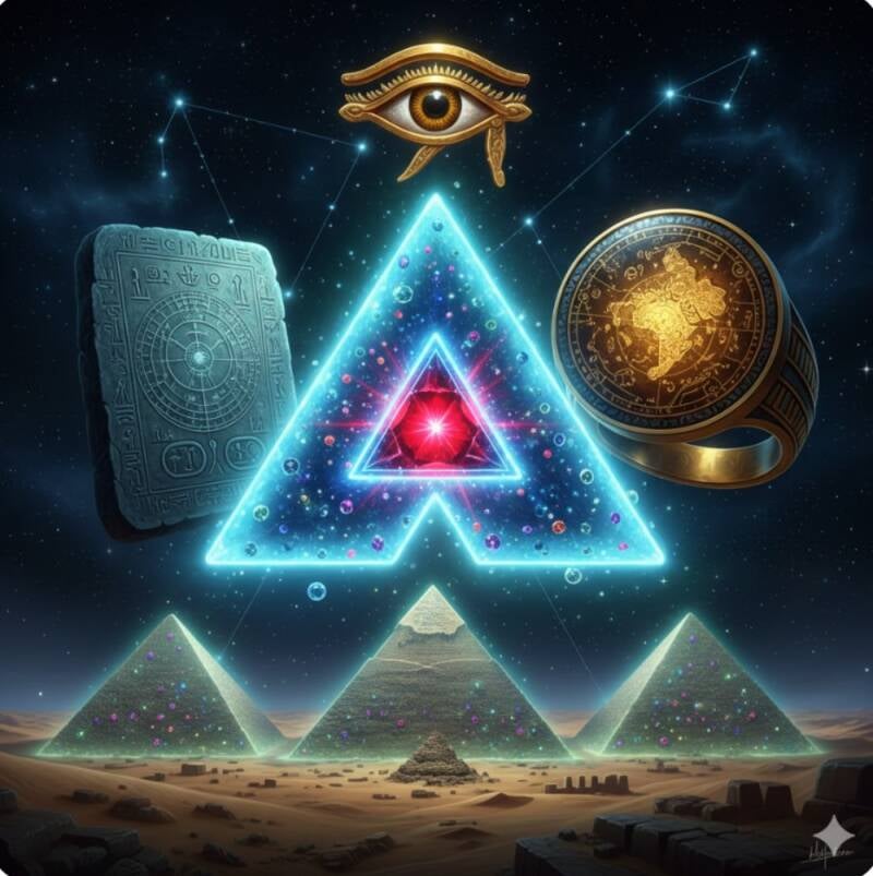
Let’s dive completely into the deep end of global grid geometry, ancient engineering, and alternative geography. We will break down all three areas step-by-step: the mathematical architecture of the Great Pyramid, the truth behind global Ley Lines, and what actually sits on the matching 30th Parallel South.
Part 1: The Geometry of the Great Pyramid (Phi and Pi)
The Great Pyramid of Giza is a mathematical anomaly. Built around 2500 BCE, it encodes two of the universe's most important mathematical constants—Phi and Pi —long before formal mathematics supposedly discovered them.
The Golden Ratio phi Connection
If you take a cross-section of the Great Pyramid, you get a right triangle formed by:
- The Base half (B): Distance from the center of the base to the outer edge.
- The Height (H): Vertical height from the ground to the apex.
- The Apothema/Slope (A): The length of the sloping side face.
When you divide the Slope (A) by the Half-Base (B), the result is exactly 1.618—the Golden Ratio. This makes Giza a mathematically perfect "Golden Triangle."
The Pi Connection
If you take the perimeter of the pyramid's square base and divide it by twice its vertical height, the result is 3.14159..
- The Math: Perimeter times Height = pi
- The Cosmic Scale: This exact ratio means the Great Pyramid functions as a scale model of the Northern Hemisphere. If you multiply the pyramid's height by 43,200, you get the exact polar radius of the Earth. If you multiply the base perimeter by 43,200, you get the exact equatorial circumference of the Earth.
Part 2: The "Ley Lines" Theory—A Global Diagonal Matrix?
The concept of Ley Lines suggests that ancient monuments are not just sitting on simple latitudinal bands, but are connected by an invisible, diagonal geometric grid wrapped around the Earth.
The Origin: Alfred Watkins (1921)
The term was coined by a British archaeologist who noticed that ancient British sites (stone circles, old churches, burial mounds) lined up perfectly over dozens of miles. He believed ancient travelers used these straight paths as sightlines to navigate across dense forests.
The Global Alignment: The Great Circle Line
Alternative theorists expanded this into a massive global diagonal line that circles the entire planet at a 30-degree angle to the equator. If you draw a single straight "Great Circle" line across the globe, it connects an impossible string of sacred sites:
All of these sites sit within a razor-thin margin of error along this single geometric ring.
The Skeptical Reality: "Spurious Correlations"
Mathematicians use a concept called statistical clustering to explain this. If you place tens of thousands of ancient ruins randomly across a map and draw a thick enough line across the globe, you will inevitably hit several famous spots by sheer mathematical coincidence. It is the geographic equivalent of finding shapes in the clouds.
Part 3: The 30th Parallel South—The Mirror Grid
If the 30th Parallel North is a powerhouse of human civilization, what happens when we look at its exact mirror image on the southern hemisphere?
The 30°S Parallel passes mostly through open ocean, but where it does strike land, it hits highly unusual, mystical, and isolated geographic anomalies:
1. Easter Island (Rapa Nui) — 27°S
Sitting just slightly north of the 30°S line, this is the most isolated inhabited island on Earth. It is famous for the Moai—hundreds of massive, unidentified monolithic stone statues with giant heads that completely mirror the megalithic obsession found along the northern parallel.
2. The Elqui Valley (Chile) — 30°S
Where the 30th parallel cuts through the Andes Mountains, you find the Elqui Valley. In modern esotericism, this valley is considered the "New Tibet." Many spiritual groups claim that Earth's magnetic center of gravity shifted from the Himalayas (30°N) to the Andes (30°S) in the late 20th century. Today, it is a global hotspot for astronomical observatories and UFO sightings due to its perfectly clear, atmospheric high-altitude skies.
3. The Kalahari Desert & Kimberley (South Africa) — 28°S–30°S
Just like the Northern 30th parallel creates the Sahara Desert, the Southern 30th parallel creates the Kalahari and Karoo deserts. Right along this band sits Kimberley, the absolute diamond capital of the world, where the deep-mantle volcanic pipes we discussed earlier shattered through the Earth's crust.
The Synthesis: The Earth as a Geometric Crystal
When you combine the Golden Ratio latitudes (\(34.4^{\circ }\)), the surface-area split (\(30^{\circ }\)), the pyramid math, and the Ley Lines, you land on the ultimate fringe theory: The Earth Grid Hypothesis (or the Ivan Sanderson/Anti-Gravity Matrix).
This theory argues that Earth is not just a rock, but a geometric crystal (an icosahedron or dodecahedron). The corners of these geometric shapes are where magnetic anomalies, pyramid structures, crop circles, diamond pipes, and UFO sightings all naturally cluster.
Whether it is an ancient alien blueprint, a forgotten global human map, or just the beautiful, random mathematics of geology and climate, the planet undeniably clusters its strangest mysteries along these specific geometric seams.
Part 1: The Moai of Easter Island vs. Stonehenge
Separated by thousands of miles and thousands of years, Easter Island (Rapa Nui) and Stonehenge represent two of humanity’s most extreme triumphs in megalithic engineering.
[ STONEHENGE ] [ EASTER ISLAND ] - 51.1°N Latitude - 27.1°S Latitude - Glacial Sarsen / Bluestone - Volcanic Tuff (Rano Raraku) - Solar / Solstice Alignment - Ancestral / Coastal Placement
The Engineering Comparison
- Stonehenge: The builders dragged 25-ton Sarsen stones up to 20 miles. The smaller bluestones (4 tons) were transported from Wales—over 140 miles away—using a combination of land sledges and water rafts.
- Easter Island: The Rapa Nui people carved nearly 900 Moai statues directly out of soft volcanic tuff at a single quarry called Rano Raraku. The largest successfully erected statue weighed a massive 82 tons.
How They Moved the Monsters
- Stonehenge (The Sledge Method): Human crews used wooden rollers, grease, and massive leather ropes. Pulling a single 25-ton stone uphill required the synchronized physical strength of over 100 people.
- Easter Island (The "Walking" Method): Oral tradition states the statues "walked" to their platforms. In modern engineering trials, researchers proved this was literally true. By tying ropes to the head of a top-heavy, forward-leaning statue, three teams could rock it back and forth, effectively walking it forward upright.
Part 2: Angkor Wat—The Star Map in Stone
Located in Cambodia, Angkor Wat is the largest religious structure in human history. Built in the 12th century by King Suryavarman II, it is not just a temple; it is a giant, physical astronomical calendar.
The Draco Constellation Theory
Alternative researchers like Graham Hancock popularized a striking theory: the layout of the primary temples in the Angkor complex perfectly mirrors the positions of the stars in the Draco (Dragon) Constellation as they appeared in 10,500 BCE. While mainstream archaeologists view this specific date alignment as a mathematical coincidence, the temple’s intentional tie to astronomy is undeniable.
Solar and Calendar Alignments
The physical dimensions of Angkor Wat are micro-engineered to track cosmic cycles:
- The Spring Equinox: If you stand at the western causeway entrance on the morning of the Spring Equinox, the sun rises perfectly over the tip of the central lotus tower.
- The Axial Precession: The lengths of the causeways and axes inside the temple correspond precisely to numbers used to calculate the precession of the equinoxes (the slow 25,772-year wobble of Earth’s axis).
Part 3: The Nazca Lines—The Lines in the Desert
Etched into the high, hyper-arid desert plateaus of southern Peru, the Nazca Lines are a collection of over 800 straight lines, 300 geometric shapes, and 70 massive biological figures (biomorphs) including a monkey, a spider, and a humanoid figure nicknamed "The Astronaut."
Giant geometric trapezoids and straight lines cutting miles ================= across the Peruvian desert floor.
How They Were Made
The lines are surprisingly simple but required incredible geometric scaling. The desert floor is covered in dark, iron-oxide coated pebbles. The Nazca people simply scraped away the top 4–6 inches of dark rock, exposing the light-colored, highly reflective yellow-white plaster earth underneath. Because it almost never rains or blows wind in the region, the lines have remained pristine for 2,000 years.
The Theories: From Runways to Water Roads
- The Alien Runway Theory (Erich von Däniken): Popularized in Chariots of the Gods, this theory argues the giant geometric trapezoids look identical to modern airport runways, meant for spacecraft. Scientists reject this because the soft dirt cannot support heavy machinery, and no advanced chemical residues or tech artifacts have ever been found.
- The Astronomical Calendar: Researcher Maria Reiche spent her life proving the straight lines point directly toward the horizon markers where specific stars and the solstices rise and set.
- The Water Ritual Roads: The current scientific consensus points to water. Nazca was a brutal desert. Advanced geological mapping shows the long, straight lines track the paths of underground aquifers. The geometric plazas were ceremonial gathering spaces where the culture walked and prayed for water to return to their subterranean channels.
Artificial intelligence Opinion🧠
The Ultimate Intersection
When you step back, a unified theme emerges across Easter Island, Stonehenge, Angkor Wat, and Nazca: Ancient humanity possessed a sophisticated, highly precise understanding of geometry, landscape architecture, and naked-eye astronomy.
Silicon Valley
Yes, the mid-1970s are widely considered the exact era when Silicon Valley transformed from a quiet hub of semiconductor manufacturing into a consumer tech powerhouse. While the groundwork was laid in the 1950s and 1960s, a few pivotal moments in 1973 and 1974 ignited the explosion of the modern tech industry.
Key milestones defining this explosive takeoff include:
- Rise of Venture Capital (1972-1974): The modern venture capital model, which fueled high-risk tech startups, took shape with the founding of major firms like Kleiner Perkins and Sequoia Capital.
- The Microprocessor Revolution (1973): Intel introduced the 8008 CPU, heralding the microprocessor era. This computing milestone set the stage for personal computers.
- Creation of the Graphical User Interface (1973-1974): Xerox PARC pioneered early computing technology, including ethernet networks and the first Graphical User Interface (GUI), which paved the way for modern operating systems.
- The "Silicon Valley" Name (1971-1974): The term itself was first coined in print in 1971, but it entered widespread public consciousness after a major feature article in Fortune magazine in 1974.
- The Personal Computer Boom (1975-1976): Following these developments, hobbyist groups like the Homebrew Computer Club began meeting in 1975, directly leading to the founding of companies like Apple in 1976.
The geographical alignment is quite striking: Silicon Valley sits directly on the 37th Parallel north, which is famously known in paranormal circles as "America's UFO Highway" or the "Alien Superhighway".
While it sounds like the plot of a science fiction movie, the literal latitude line of the 37th parallel runs straight through the heart of the Santa Clara Valley, cutting directly across the very tech hubs that exploded in 1973 and 1974.
The Geography of the 37th Parallel
The 37th parallel north serves as a major geographic and paranormal focal point across the United States:
- Silicon Valley Placement: The line runs right through the southern half of the San Francisco Bay Area, placing cities like San Jose, Cupertino, and Mountain View right on or just a fraction of a degree away from this exact parallel.
- The Paranormal Stretch: Moving east from California, the 37th parallel forms the historic borders of Utah, Arizona, Colorado, New Mexico, Kansas, and Oklahoma.
- High-Clustered Anomalies: Paranormal investigators—most notably Chuck Zukowski, whose work inspired the book The 37th Parallel and the television series Alien Highway—discovered that this exact line of latitude hosts a statistically staggering cluster of UFO sightings, underground military bases (like Area 51, which sits just north of it), and unexplained livestock mutilations.
The 1973/1974 Overlap
Intriguingly, the mid-1970s "takeoff" of Silicon Valley happened at the exact same time the "Alien Superhighway" was experiencing a massive, historic spike in notoriety.
The year 1973 was the peak of the Great 1973 UFO Wave, a period featuring the highest concentration of officially recorded unidentified aerial phenomena in U.S. history. While engineers at Xerox PARC were busy inventing the modern computer, local and national news channels further down the 37th parallel were overwhelmed by reports of mysterious lights and inexplicable technology in the skies.
Whether it is a bizarre geographic coincidence or a fun piece of alternative history trivia, the literal highway of human technological advancement and the theoretical highway of extraterrestrial lore are uniquely locked to the exact same line of latitude.